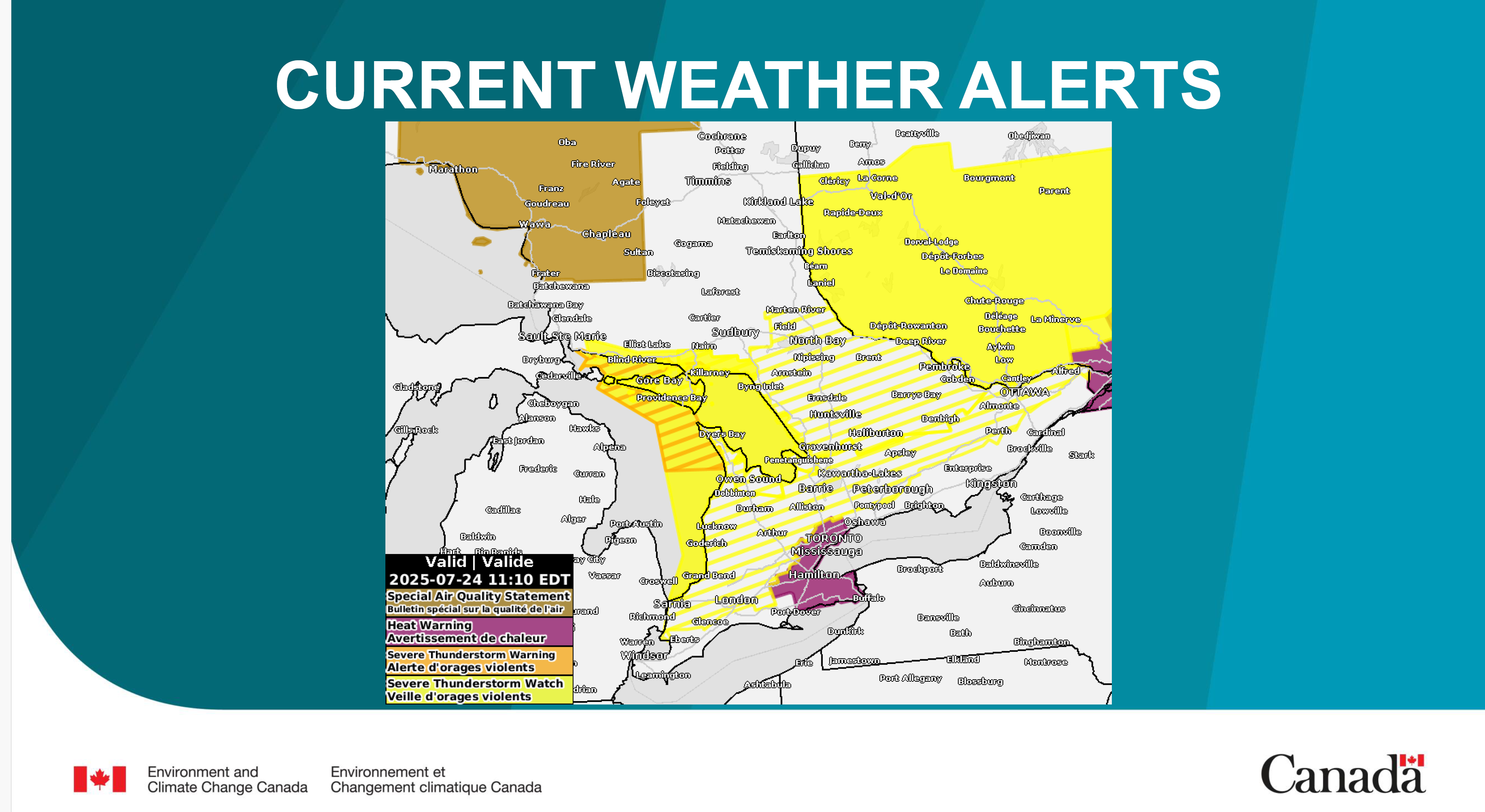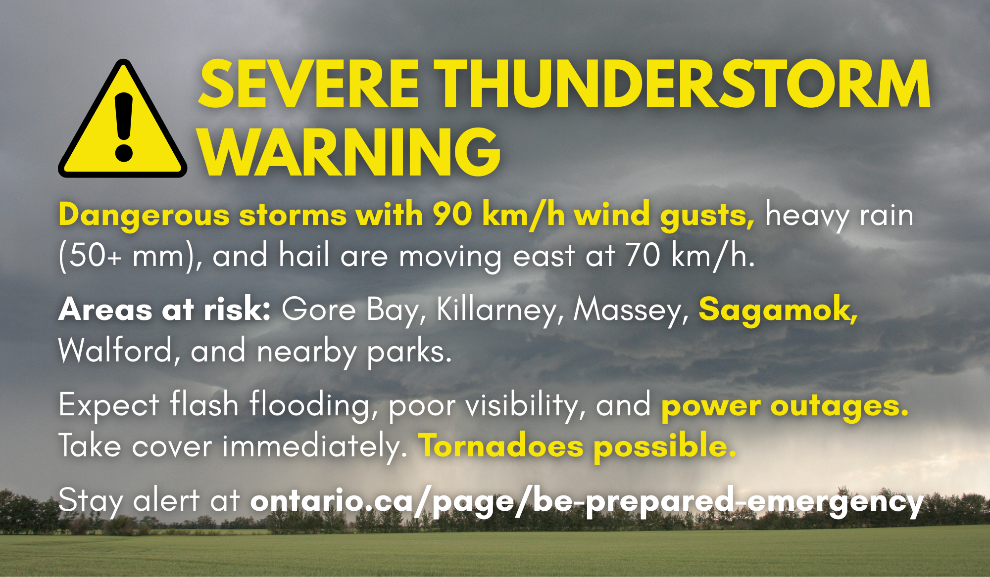
At 1:48 PM EDT, Environment Canada meteorologists are tracking a line of severe thunderstorms capable of producing very strong wind gusts, pea to dime size hail and heavy rain. This line of severe thunderstorms is located from Grassy Lake to 35 kilometres south of Burnt Island, moving east at 70 km/h.
Hazards: 90 km/h wind gusts Torrential rainfall with amounts possibly in excess of 50 mm Locations impacted include: Gore Bay, Killarney, Walford, Blue Jay Creek Provincial Park, Massey, Chutes Provincial Park, La Cloche Provincial Park, McGregor Bay and Killarney Provincial Park. Utility outages are likely. Heavy rain will likely cause flash flooding and significant reductions to visibility.
Take immediate cover if a thunderstorm approaches. If outside, protect yourself from flying debris and hail. Emergency Management Ontario recommends that you take cover immediately if threatening weather approaches. Severe thunderstorms can produce tornadoes. Severe thunderstorm warnings are issued when imminent or occurring thunderstorms are expected to produce damaging hail, wind or rain. Please continue to monitor alerts and forecasts issued by Environment Canada.
To report severe weather, send an email to ONstorm@ec.gc.ca or post reports on X using #ONStorm. For more information: ontario.ca/page/be-prepared-emergency.